Overview
SW Corvallis is growing and changing. Large vacant areas and opportunities for infill, especially near Oregon State University, make it one of the city’s most active areas for future development. At the same time, much of the neighborhood reflects older development patterns, with limited street connections, car-focused design, and gaps in sidewalks and bike paths.
The SW Corvallis Area Plan creates a vision for connected, livable neighborhoods with a mix of housing, transportation options, and community amenities. The Plan is a response to new state policies on middle housing and the community’s desire for safe, walkable streets and a stronger neighborhood identity.
Get Involved!
Thank you for attending the SW Corvallis Area Plan Community Meeting on December 6 at Adams Elementary School!
The Online Survey is now closed. Than you for providing your feedback!
Please stay tuned for a summary of the public meeting and online survey themes. The summary will be posted on the Project Library page.
The SW Corvallis Area Plan will:
-
![]()
Plan for a Vibrant Future
SW Corvallis will include lively neighborhoods filled with a mix of housing types, shops, schools, workplaces, and parks that welcome people of all ages, incomes, and abilities.
-
![]()
Support Community connection & convenience
SW Corvallis will include safe streets, walkable neighborhoods, and easy travel options for walking, biking, transit, and driving.
-
![]()
Encourage housing choices for everyone
The SW Corvallis Area Plan will work to provide a variety of housing types that will fit the character of the area and will suit the needs of locals at all stages of life.
-
![]()
Be a plan built to last
The SW Corvallis Area Plan will reflect both community priorities and state requirements, laying the foundation for SW Corvallis to thrive.


Project Study Area

The SW Corvallis project study area is located west of Marys River and spans to the western border of the Corvallis Urban Growth Boundary (UGB). The northern boundary is the Portland and Western rail line that connects with Reservoir Avenue to the west. The southern boundary is the southern Corvallis UGB boundary, just south of Nash Avenue.
Project
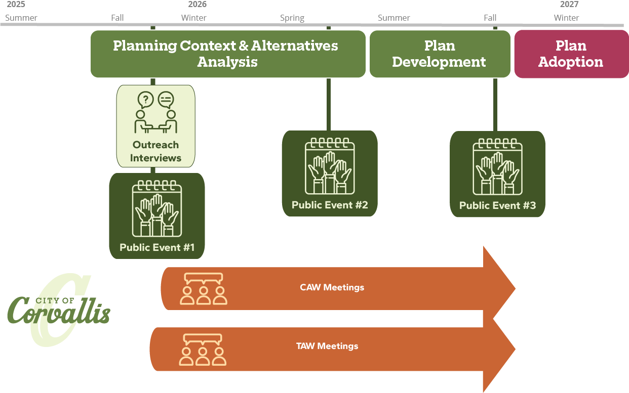
The schedule identifies engagement activities and key milestones over the course of the project.
schedule
our Workgroups
Technical Advisory Workgroup (TAW)
The TAW will review technical issues related to the project, such as implementation of OAR 660-012 and transportation modeling.
The TAW consists of representatives from the City of Corvallis, Benton County, Safety and Emergency Service Providers, the School District and Oregon State University, the Corvallis Area Metropolitan Planning Organization, the Oregon Department of Transportation, and the Department of Land Conservation and Development.
cOMMUNITY aDVISORY Workgroup (CAW)
The CAW will review project deliverables for the SW Corvallis Area Plan and provide their input and perspective as representatives of the community.
The CAW consists of residents from the SW Corvallis Area, local businesses, pedestrian and bicycle advocates, elderly and youth groups, low-income individuals, disabled individuals, and transportation options and public transportation providers.
Contact Us
Contact us with any questions or comments on the SW Corvallis Area Plan! By entering your email you will be signed up for project updates.